When Is North Cascades Highway 20 Open? Seasonal Access Guide
Quick verdict
Highway 20 through the North Cascades usually works best for full west-to-east trips from late July through September, but spring openings, fall closures, snow, washouts, smoke, parking pressure, and current road status can change the plan fast.
The most important question is not only whether “the North Cascades are open.” It is which road segment, trailhead, campground, visitor facility, or town base is actually reachable for your trip.
Last updated: July 2026
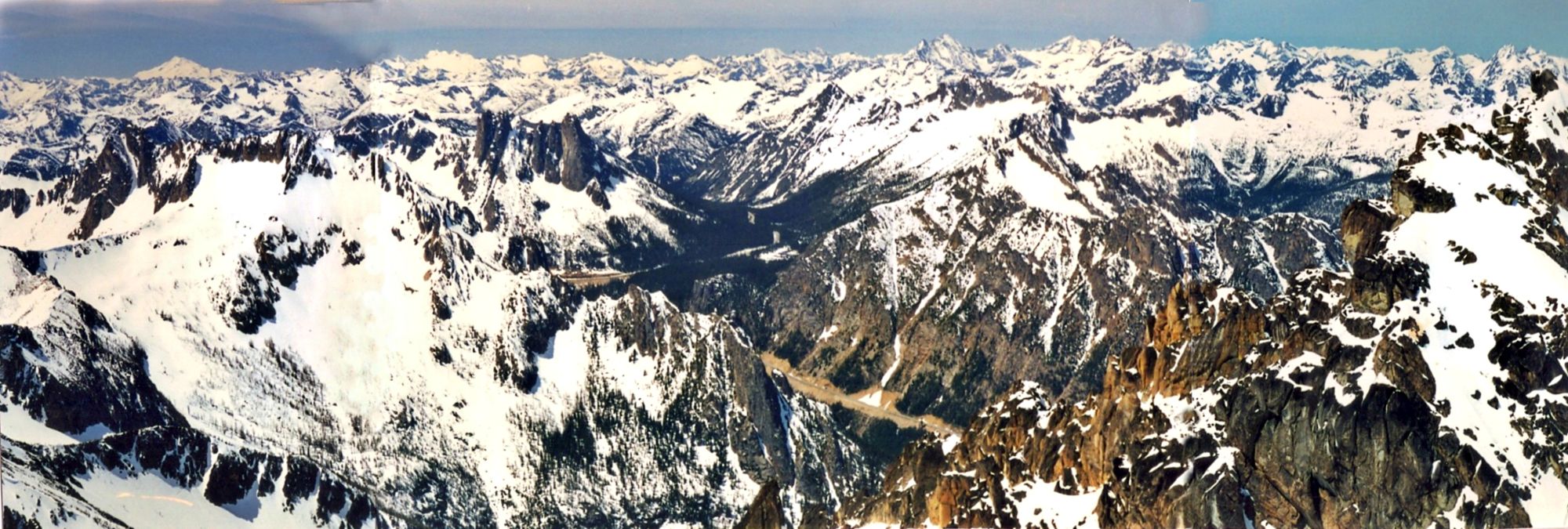
Attribution: Wikimedia Commons (CC BY-SA 4.0)
Use this guide to figure out what is realistically reachable before you build the rest of your North Cascades trip. If you are traveling soon, start with current conditions. If you are choosing a month, start with the best-time guide. If SR 20, Washington Pass, Cascade River Road, or high-elevation trailheads are uncertain, build a backup plan before committing to hikes, lodging, camping, or a long one-day route.
This is an evergreen seasonal access guide. For live road closures, smoke, fire restrictions, or same-week changes, confirm with the Current Conditions page, the WSDOT SR 20 status page, and the NPS road conditions page.
What are you trying to figure out?
Fast seasonal access decision guide
Winter: Do not plan a full Highway 20 crossing over Washington Pass unless official road status says it is open. Winter trips usually mean west-side access around Rockport, Marblemount, Newhalem, Diablo, and lower-elevation stops, or an east-side Methow Valley trip reached from the east.
Spring: Spring is the most misleading season. The weather may feel mild in the lowlands while high-elevation roads, trailheads, campgrounds, and toilets are still snow-covered, storm-damaged, or closed. Treat April, May, and much of June as partial-access season.
Summer: Summer usually gives you the widest access, especially from mid-July into September. Road closure is not the only issue, though. Parking, campground reservations, smoke, fire restrictions, heat, and busy trailheads can still change the day.
Fall: Fall can be excellent, especially for larches and cooler hiking weather, but the margin gets smaller. Shorter days, early snow, icy mornings, reduced services, and eventual SR 20 closure risk all matter.
Start with the access zone, not the attraction
Before choosing hikes or scenic stops, figure out which access zone your plan depends on. This is more useful than asking whether “North Cascades National Park is open,” because different parts of the corridor behave differently.
Lower west-side corridor: This includes Concrete, Rockport, Marblemount, Newhalem, Gorge Creek Falls, Diablo Lake viewpoints, Ross Dam access, and nearby lower-elevation stops. This is usually the most useful fallback zone when the higher pass section is closed, visibility is poor, or you are arriving late.
High Highway 20 pass corridor: This includes Rainy Pass, Washington Pass, Rainy Lake, Blue Lake, Maple Pass, Cutthroat, Easy Pass, and other high-elevation stops near the crest. These areas depend heavily on SR 20 status, lingering snow, early storms, and parking pressure.
Cascade River Road and side-road trailheads: Do not treat side-road access as automatic. Cascade River Road, high trailheads, and forest roads can have different closure timelines than Highway 20. Check road conditions separately before planning around Cascade Pass, Sahale Arm, or other side-road-dependent destinations.
East side / Methow Valley: Mazama, Winthrop, Twisp, Pearrygin Lake, and some east-side recreation can still work as a Methow trip even when a through-drive across SR 20 does not. Do not assume a Methow trip and a Diablo/Newhalem trip are interchangeable.
Services and overnight access: Campgrounds, visitor centers, food, gas, toilets, and ranger services are separate access questions. You can have an open road but limited services. Check facility status before building a trip around a campground, visitor center, or late-day stop.
Access patterns by season
This is not a best-time-to-visit ranking. It is the access reality behind each broad season.
Winter access: In winter, do not build a trip around reaching Rainy Pass, Washington Pass, or high Highway 20 trailheads unless the WSDOT SR 20 status page shows the road is open through that section. Plan around lower west-side access, Skagit River stops, Newhalem-area options, winter eagle viewing, or Methow Valley recreation reached from the east.
Spring access: Spring is a transition season. Even when plowing progresses or the highway reopens, higher trails, shaded trailheads, side roads, campgrounds, and toilets may still be limited by snow, storm damage, or seasonal operations. Open highway access does not mean alpine hiking is ready.
Main summer access: Mid-summer is usually the easiest time to build a full Highway 20 corridor trip, but access pressure shifts from snow and closures to parking, crowds, campground availability, heat, and smoke. Your access problem becomes less about whether you can reach a place and more about whether you can park, see anything, or stay nearby.
Fall access: Fall can be excellent, especially near the high passes, but it is less forgiving. Early snow, shorter daylight, colder mornings, icy pavement, reduced services, and larch-season crowds can all change access strategy.
Late fall and early winter transition: This is the season when assumptions fail fastest. A route that worked recently may not be practical after new snow, rockfall, storm damage, or seasonal service reductions. Check WSDOT SR 20 status and NPS road conditions, then build the day around the lowest-risk reachable zone.
The roads and services to check before you drive
Use this order. It prevents you from wasting time checking trail details for a destination you cannot even reach.
1. Check SR 20 first: SR 20 controls the basic Highway 20 corridor plan, especially access toward Rainy Pass, Washington Pass, and the east side. Start with the WSDOT SR 20 status page.
2. Cross-check NPS road conditions: NPS road conditions help clarify park-specific access issues, including roads, closures, repairs, and notes that may affect the lower corridor, Cascade River Road, and the park complex. Check the NPS road conditions page.
3. Check the specific side road or trailhead: If your destination is not directly on Highway 20, check it separately. This matters for Cascade River Road, high trailheads, forest roads, and trailheads that hold snow longer than the main highway.
4. Check campground and visitor center operations: Road access does not guarantee campground access, visitor center hours, water, toilets, or staffed services. Check NPS hours and seasons and NPS camping information if your plan depends on facilities.
5. Check weather, smoke, and fire restrictions: This matters most in late summer and fall, but it can affect any trip. If your plan depends on long views, high trailheads, campfires, or clear air, check conditions before leaving cell service.
Common seasonal access mistakes
- Assuming Diablo Lake being accessible means the whole highway is open. West-side access to Newhalem, Diablo, or Ross Lake does not always mean SR 20 is open across Washington Pass.
- Planning high-elevation hikes too early. Trails near Rainy Pass, Washington Pass, Cascade Pass, and other high trailheads often lag behind lowland weather by weeks or months.
- Assuming road access means trail access. A road may be open while nearby trails still have snow, mud, blowdown, water crossings, or early-season hazards.
- Assuming summer access means easy parking. July, August, September, and larch weekends can fill popular lots early.
- Assuming campgrounds follow the same season as the highway. Campground reservations, water, toilets, open loops, and services can change separately from road status.
- Assuming the east side and west side are interchangeable. A Methow Valley trip, a Diablo Lake trip, a Cascade River Road trip, and a full Highway 20 crossing are different plans.
If access changes, use this fallback logic
If SR 20 is open through your main goal: Pick one main anchor, then build the rest of the day nearby. Do not overstuff a long corridor day just because the road is open.
If SR 20 is closed beyond the west-side corridor: Shift to a west-side plan around Marblemount, Newhalem, Gorge Creek Falls, Diablo Lake viewpoints, Ross Dam, short walks, and lower-corridor stops.
If SR 20 is only useful from the east: Think Mazama, Winthrop, Twisp, Washington Pass from the east side if reachable, Pearrygin Lake, and Methow Valley recreation. Do not treat this as the same trip as Diablo Lake or Newhalem.
If Cascade River Road is closed or limited: Switch away from Cascade Pass or Sahale Arm planning and return to the Highway 20 corridor. Check the NPS road conditions page, then choose a reachable alternative based on how much of the corridor is open.
If parking fails: Do not waste the best part of the day circling. Move to the next planned stop, then decide whether to retry later. Popular summer and fall trailheads need backup stops chosen before arrival.
If smoke or visibility kills the views: Shift to short walks, river stops, waterfalls, visitor center stops, food/service stops, or a guided activity. Viewpoint-heavy plans are fragile when visibility is poor.
Access planning by trip type
Seattle day trip: Be conservative. A day trip has little room for access surprises. Check the WSDOT SR 20 status page, choose one main goal, and set a turnaround point before you leave. If conditions are questionable, use the west-side corridor instead of forcing a high-pass day.
One-night or weekend trip: Choose your base based on the next morning’s first real goal. Stay west for Newhalem, Diablo, Ross Lake, and Cascade River Road. Stay east for Washington Pass, Rainy Pass, Blue Lake, Cutthroat, Mazama, or Winthrop.
Family or mixed-ability trip: Build around dependable stops first: visitor centers, overlooks, short walks, bathrooms, food, and weather-flexible options. Save high-elevation trailheads for when road and trail conditions are clearly favorable.
Camping trip: Check campground opening status, reservation requirements, water, toilets, and fire restrictions separately. A nearby road being open does not mean your campground is open or available. Use NPS camping information before committing to an overnight plan.
High-elevation hiking trip: Check three things: the road, the trailhead, and the trail surface. The most famous hikes are often the least forgiving for late starts, lingering snow, parking failure, or access uncertainty.
Final pre-drive checklist
- Check WSDOT SR 20 status before planning anything near Rainy Pass, Washington Pass, or the east side.
- Check NPS road conditions for park roads, Cascade River Road, and current access notes.
- Check NPS hours and seasons if your plan depends on visitor centers, ranger stations, or park facilities.
- Check NPS camping information if you are planning to sleep inside the park complex.
- Check weather, smoke, fire restrictions, and visibility before long summer and fall drives.
- Pick a backup before leaving cell service.
Related guides
Plan the route
Pick safer backups
Handle logistics
Bottom line: For North Cascades access, do not ask only whether the park or highway is “open.” Ask what specific road segment, trailhead, campground, visitor facility, or town base your trip depends on, then confirm that piece before you drive.