
Rockport State Park: Day-Use and Trail Guide for Highway 20
Last updated: May 2026
Rockport State Park is a lowland forest stop on Highway 20, west of Marblemount and well before Newhalem, Diablo Lake, and Washington Pass. Use it for a quiet old-growth walk, picnic break, rainy-day backup, or family nature stop, not for big views or a destination hike.
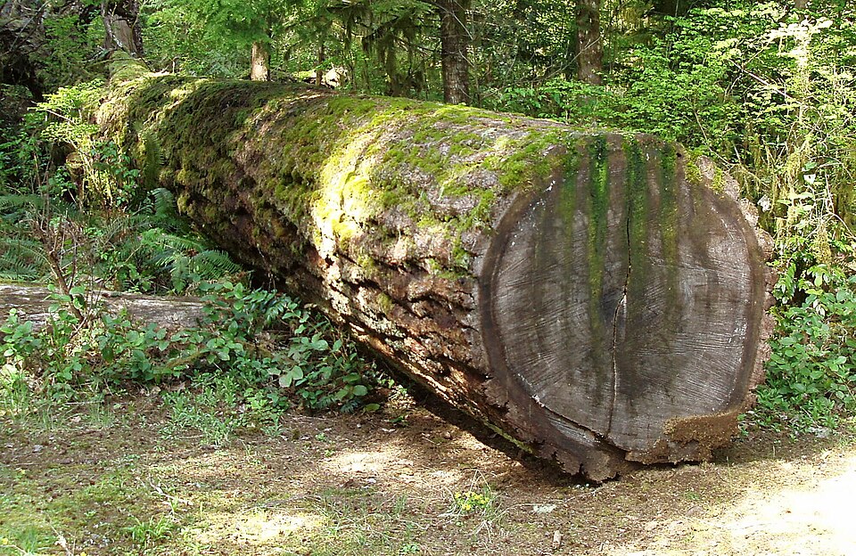
Fallen nurse log inside Rockport State Park old-growth forest | CC BY 2.0
Get the weekly North Cascades planning update before choosing hikes, overlooks, or backup stops along Highway 20.
Quick Decision Guide
- Best reason to stop: You want a short forest walk before Marblemount or before the bigger North Cascades scenery starts near Newhalem and Diablo.
- Time needed: Plan on 20-30 minutes for a restroom, picnic, or quick look. Plan closer to 1-2 hours if you want to walk the forest trail network.
- Best with kids: Stop here if kids need movement before the longer drive east toward Newhalem, Diablo Lake, or Washington Pass.
- Best in poor weather: The forest is more useful than open viewpoints when clouds hide the peaks east of Marblemount.
- Skip it if: Your goal is mountain views, waterfalls, alpine trails, larches, or a fast photo stop near Diablo Lake.
My practical take: Rockport State Park is best as a smart add-on, not the main event. If you are driving all the way to Diablo Lake or Washington Pass in good weather, keep moving east and save Rockport for the return drive or a bad-weather day.
Where It Fits
Rockport State Park sits along Highway 20 near Rockport, west of Marblemount and west of the main North Cascades National Park corridor. This makes it an early stop if you are driving from the west side toward Newhalem, Diablo Lake, Washington Pass, or Winthrop.
The park is different from nearby river parks and mountain trailheads because its main value is forest. You are coming here for old-growth trees, short trails, shade, picnic space, and a lower-stress walk. You are not coming here for a summit, lake view, waterfall, or alpine route.
This is where people misjudge the corridor: Rockport still feels “near the North Cascades,” but it is not the same type of stop as Diablo Lake Overlook or Washington Pass. It is a quiet lowland forest break before the road climbs into the more dramatic part of the trip.
Day-Use Logistics
- Location: Rockport State Park is on State Route 20 near Rockport, before Marblemount if you are driving east.
- Pass: A Discover Pass is required for day-use parking at Washington State Parks.
- Parking: Use the main park parking area near the day-use facilities and trail access. This is easier than trying to use smaller mountain trailheads nearby.
- Restrooms: Restrooms are part of the day-use facilities. Winter operations can change water availability.
- Picnic use: Picnic tables are available first come, first served. This makes the park useful before or after Marblemount when you want a quieter food stop.
- Dogs: Dogs are allowed under state park pet rules. Keep them leashed and clean up after them.
- River access: Do not assume this is a Skagit River access stop. The park does have a path across the highway that goes along the river, but river access is not the reason to come here.
Common mistake: Do not use a national park pass here and assume you are covered. This is a Washington State Park, not a National Park Service site, so the Discover Pass rule is the key parking detail.
Access: If accessibility is a deciding factor, check the official park page before you drive. Lowland forest trails can be affected by storms, roots, water, and maintenance needs, so the mapped route may not tell the whole story for the day you visit.
Trails and Walking Options
Rockport State Park’s trail system is better understood as a network of short forest segments than as one major hike. The official park map shows short pieces that can be linked into a longer walk, with several 0.1- to 0.5-mile segments around the forest, picnic area, service roads, and river-side trails.
- Evergreen Trail: The main forest-walk option. Use it when you want the most complete Rockport State Park experience before continuing east to Marblemount or Newhalem. Expect roots, shade, damp forest, and a slower pace than the map may suggest.
- Fern Creek Trail: A short interior forest add-on. It is best if you already stopped for the Evergreen area and want a little more time among the larger trees without turning the stop into a half-day plan.
- West Loop Interpretive Trail: The best fit for an interpretive forest walk when trail access and conditions match your group. This is the part to check most carefully if someone in your group needs easier walking.
- Sauk Springs Trail and Skagit View Trail: Shorter options south of the main forest side of the park, closer to the Skagit River side of Highway 20. Use these if you want a brief walk and a river-overlook feel, not river access.
Local planning note: The forest trails can feel shorter on paper than they do in wet weather. If you are trying to keep a Highway 20 day moving, set a hard turnaround time before you start walking.
Seasonal Notes
Winter: Rockport State Park is more useful than many higher-elevation stops because it sits low on the west side of the corridor. Expect wet trails, dark forest, mud, roots, and possible storm debris. Bring water if you are visiting in the off-season because winter water service can be limited.
Spring: Spring is one of the better times to use this park. The forest is green, the high trails east of Marblemount may still be snowed in, and Rockport gives you a walk that does not depend on alpine access.
Summer: Use it as shade, picnic space, or a quieter stop before Marblemount. Do not make it your main summer stop if your group wants lakes, overlooks, or mountain hikes farther east.
Fall: Rockport works best as a lowland forest walk when weather is mixed or the high trails are becoming less dependable. It is not a larch stop, so do not compare it with Maple Pass, Blue Lake, Cutthroat-area trails, or Washington Pass.
Nearby Tradeoffs
- Howard Miller Steelhead Park: Better if you want a river-park feel near Rockport. Rockport State Park is better if you want forest walking.
- Sauk Mountain: Better if you want mountain views and a real hike. Rockport State Park is better if you want a dependable lowland stop without committing to a steep access road or smaller trailhead.
- Newhalem area walks: Better if you are already farther east and want short walks tied to the North Cascades park corridor. Rockport is better before Marblemount when you want to stop earlier.
- Diablo Lake Overlook and Gorge Creek Falls: Better for quick scenic payoff. Rockport State Park is better when weather blocks views or when the group needs shade, restrooms, and a quieter walk.
- Cascade River Road trailheads: Better for bigger hiking goals when access and parking work. Rockport is better for a low-risk backup west of Marblemount.
Sources
- Official park page - confirms location, facilities, trails, day-use details, pet rules, and park contact information.
- Official park map - confirms trail names, short segment distances, parking, restrooms, picnic area, and trail layout.
- Discover Pass page - confirms day-use pass requirements and current pass information.
- Winter schedule - confirms winter operation notes, including water and restroom changes.
- State park rules - confirms general pet, leash, wildlife, and park-use rules.
Related Guides
Conditions, fees, access, and park operations can change. Check official sources before you drive, especially in winter, after storms, or when accessibility is a deciding factor.